
Wauwatosa Neighbor Lookup Sources
Each public source sees a different part of a Wauwatosa block. WAGEO shows parcel geometry and owner fields. The city tax portal provides property and mailing details. MyVote is limited to individual checks, while neighborhood associations publish civic contacts rather than household rosters. Historical directories can recreate an earlier block.
| Source | Block evidence | Access route |
|---|---|---|
| WAGEO | Nearby parcels, situs, owner, taxkey, zoning | Free map and REST layer |
| City tax portal | Owner, property address, survey, current and historical property | Free portal |
| MyVote Wisconsin | One registration or address-based self-check | Free, not a block list |
| NAC directory | Neighborhood name and public civic contact | City map and council pages |
| Criss-cross directories | Past names arranged by address | Library and archives |
A parcel owner may be a person, company, trust, or public body. Its mailing address can match the situs or differ. Neither fact creates a complete list of Wauwatosa neighbors, relatives, or other occupants.
WAGEO Finds Wauwatosa Neighbors
The Wauwatosa WAGEO viewer includes Search, Select, Query, Buffer, layers, legend, measure, and print controls. Parcel data can expose address, taxkey, owner and mailing fields, zoning, class, values, legal description, acreage, floodplain status, and assessment-neighborhood fields.
Those are land and tax facts. They help a searcher walk from one lot to the next, but do not prove that an owner lives there. When the map is not enough, the public REST layer can return selected attributes or GeoJSON for a bounded set.
The public WAGEO map is the official visual starting point for an adjacent-parcel search.
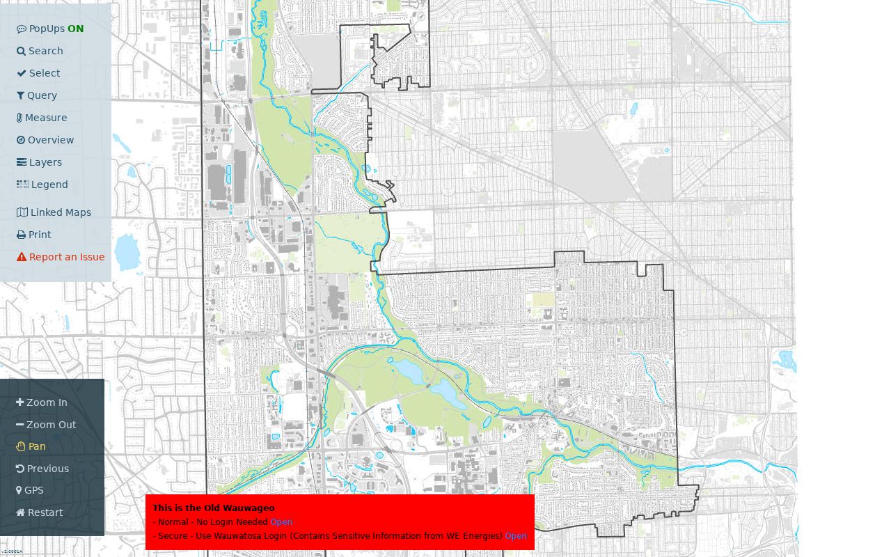
The viewer's selection and layer controls help keep a neighbor lookup tied to a defined block instead of an unsupported list of people.
Map a Wauwatosa Neighbor Block
Start with one verified address and expand only far enough to answer the block question. Adjacent parcels touch or sit near the selected lot. A buffer draws a radius that can cross streets and association lines.
- Search the address in WAGEO and confirm the parcel taxkey.
- Use Select, Adjacent Parcels, or a small Buffer to define the area.
- Record situs, owner, mailing address, and legal description separately.
- Use Query in selection to narrow by street, ZIP, zoning, or parcel fields.
- Confirm uncertain fields in the city tax portal.
The flow is address to parcel to adjacent lots to owner fields to verification. For every house on a named road, use the Wauwatosa street directory.
Wauwatosa Neighborhood Directory
The city's neighborhood association map and Wauwatosa Neighborhood Associations Council identify 33 associations in the November 2024 inventory. The GIS polygon layer helps route civic questions. It is not a deed boundary or resident roster.
| Area | Examples | Best use |
|---|---|---|
| Central and east | Tosa Village, Pabst Park, Tosa East Towne | Public civic contact |
| Historic names | Washington Highlands, Historic Heights, Quarry Heights | Area context |
| West and parkway | Mayfair Park, Underwood Parkway, Parkway Estates | Current association route |
| Newer entries | Ruby Gardens, Clarke's Crossing | Check current map |
An inventory year appears to mark association formation or recognition, not each home's construction date. Parcel and permit records answer building questions.
Wauwatosa Civic Boundary Quirks
A neighborhood name is useful, but the association polygon and current city map control today's civic boundary. Washington Highlands was established in 1918. Sheraton Lawns and Wellauer Heights appear with 1950, while Underwood Parkway and Clarke's Crossing are newer inventory entries.
These dates add context to neighbor research but never identify occupants or establish recorded lot lines. The parcel legal description remains the source for lots, blocks, and subdivisions.
Wauwatosa Block Context Layers
WAGEO offers more than owner names. Zoning, property class, floodplain, aerial photography, districts, utilities, and planning layers can explain why two adjacent lots look or function differently. Public aerial choices listed in the system range from 1995 through 2022.
A district layer should be checked against the current city source. Wauwatosa has announced a council transition from 16 to 12 alder districts, and the official item contains a date inconsistency. That makes the live representative map more reliable than repeating an old district number from a saved result.
Wauwatosa Voter Address Limits
MyVote Wisconsin supports self-lookup by name and birth date or by address. It does not publish a browseable roll of Wauwatosa neighbors. Separate voter-file access is regulated by Wis. Stat. §6.36. Full birth dates, license data, Social Security information, ID serial numbers, and accommodation indicators stay restricted.
A no-result may reflect input, eligibility, maintenance, or address protection. It does not prove a nearby house has no registered voter.
Official Wauwatosa Block Records
Commercial tools may merge old addresses, phone data, and inferred relationships. Official sources are narrower but clearer about purpose and custodian.
| Source | Strength | Limit |
|---|---|---|
| City parcel records | Land, owner, map context | Not a household list |
| Official voter channel | Self-check and regulated file route | No casual block browse |
| Association directory | Civic contacts | No full member roster |
| Commercial category | May combine sources | Age, accuracy, and provenance concerns |
Use the city record for a parcel question and the association contact for a civic question. Avoid turning either into a claim about every person at a home.
Past Wauwatosa Neighbors
For an earlier block, Wauwatosa's reverse-address and criss-cross directories change the method. Search the street and house number in a volume close to the target year, then record the names printed at nearby numbers. The Planning GIS historical-directory layer can match an old FULL_ADDRE to a present MATCH_ADDR across its categorized 1926-1992 material.
The 1931 citywide renaming and renumbering can break a direct address search. Use the 1932 directory and the Milwaukee 1930 conversion book before deciding that a house or neighbor is missing. Confirm every mapped match in the original directory because the GIS layer is not a complete household roll.
Wauwatosa Public Library and the Historical Society provide the in-person fallback when a volume, old street form, newspaper, or photo is not available online.
Request Wauwatosa Block Records
When a municipal record is not exposed in a portal, the City Attorney's open-records route handles city records and directs police matters to the proper custodian. Wisconsin Public Records Law, Wis. Stat. §§19.31-19.39, governs that process. Ask for an identifiable record, such as a permit or code file for a specific address and date range, rather than requesting a newly assembled neighbor list.
The office may provide electronic records, copies, inspection, or a response explaining a legal restriction. Existing records are the target. The law does not require an agency to create a fresh analysis, and protected address details must remain protected.
For a community matter, contact the association rather than trying to identify every neighbor first. The NAC model publishes routes to civic groups, not private rosters. A public contact can direct a street concern, event question, or neighborhood-history inquiry to the right volunteers while respecting households that do not appear in any association material.
Interpret Wauwatosa Neighbor Parcels
A WAGEO parcel response separates the physical address from the owner's correspondence details. Situs fields include house number, street direction, street name, street type, ZIP, and full address. Ownership fields can contain up to three owner-name lines plus an owner mailing address, city-state line, and ZIP. Those groups should never be merged into a claim that the owner occupies the parcel.
The same response may also show zoning, property class, assessment year, land and improvement values, fair-market value, gross and net tax, acreage, floodplain status, and legal description. These fields describe the land and its assessment context. They can help distinguish a home parcel from a public, exempt, vacant, or commercial site, but they do not reveal every person present. The sample parcel at 7725 Eagle Street showed matching situs and mailing information; that is evidence for that record alone, not a citywide owner-occupancy rule.
Record the taxkey for each adjacent lot before moving on. House numbers may look sequential while parcels differ in shape, frontage, or legal subdivision. The taxkey and legal description prevent a map click near a boundary from being assigned to the wrong neighbor.
Contact Wauwatosa Neighborhood Groups
The Wauwatosa Neighborhood Associations Council supplies an umbrella directory and a public contact model. The city page and GIS association polygon establish which named group is tied to an area. Start with the parcel location, turn on the neighborhood layer, and then confirm the association on the current NAC inventory. Similar names, such as Friends of Quarry Heights and Quarry Heights, make that map check useful.
The 33-group inventory includes Bluemound Manor, Charles Jacobus Park, Fisher Woods, Glenview Heights, Highland Park, Jennings Park, Mayfair Park, Olde Hillcrest, Ravenswood, Ruby Gardens, Tosa Heights, Washington Highlands, Wellauer Park, and many others. It is a civic directory, not a complete member or resident list. Public contacts can route a local-history question, association meeting issue, or community event request without disclosing private household data.
No single verified public roster was found for Wauwatosa congregations, block-watch programs, veterans groups, or fraternal organizations. For a named group and date, use the Historical Society manuscript catalog, UWM Archives, local newspaper notices, yearbooks, or the organization itself. That source-specific route is more reliable than assuming everyone near a building belonged to it.
Wauwatosa Neighbor Privacy Limits
Public maps omit household members, utility customers, delivery history, and private membership. Wisconsin Safe at Home can substitute an assigned address for eligible participants. Voter and court systems also restrict sensitive fields.
A 2025 Wisconsin law permits judicial officers to request suppression of specified residence details from land-record websites. Missing data may reflect lawful protection. Federal law also blocks vehicle records from serving as an address-history shortcut.
Lawful use. Use neighbor records for civic contact, reunion, property curiosity, or personal safety. Never watch, harass, intimidate, or harm another person.