
Walk a Wauwatosa Street Directory
A Wauwatosa street directory search is a chain, not one list. The city tax roll connects an address to a parcel and owner. WAGEO shows the lot on the street and supplies taxkey, legal description, and public map layers. A recorded deed ties named grantors and grantees to that legal description. MyVote is limited to a person's own registration check, while printed criss-cross directories can supply historical address-to-name snapshots. Follow each source only as far as its stated purpose allows.
- Enter the house number and street in the city tax portal. Save the parcel number, taxkey, owner, and full address.
- Open the parcel in WAGEO. Turn on parcel boundaries, address, and taxkey, then inspect each lot separately.
- Compare situs and owner-mailing fields. Do not infer occupancy merely because they match.
- Search the Milwaukee County deed index by the owner or grantee, then verify the legal description and recording date.
- For a past household, consult the correct directory year and bridge any old street name through the 1931 conversion records.
Search Wauwatosa Streets Precisely
The Wauwatosa City Tax Web Portal supports parcel, alternate parcel, owner, address, survey, municipality, and current or historical property controls. Partial owner or address terms can return several matches. Its instructions say to omit a directional prefix and street type for a basic address search, an unusual point because the resulting GIS record retains both fields.
| Field | Control | Street-directory use |
|---|---|---|
| House # | Text | Target one street number |
| Street Name | Text | Return partial street matches |
| Owner | Partial-name search | Find other parcels under the spelling |
| Parcel # | Identifier | Open the exact city parcel |
| Historical Properties | Checkbox | Include inactive city records |
The separate assessor comparison form takes parcel number, a low and high house number, street name, optional suffix, and assessment year. A house-number range is useful for sampling a block, but each returned parcel still needs its own review.
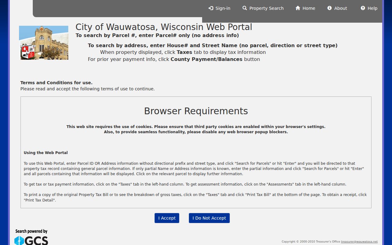
The city portal screenshot shows the separate search modes that keep an address query distinct from an owner or survey query.
Browse Wauwatosa Parcels by Street
The WAGEO viewer turns a street name into map geography. Search one confirmed address, select its parcel, and turn on Parcel Boundary, Address, and Taxkey. Pan in sequence rather than assuming that the next house number is the next legal parcel. Alleys, rights-of-way, irregular lots, and land divisions can disrupt number order.
WAGEO offers Search, Select, Query, Measure, Buffer, Layers, Legend, linked maps, and print controls. Query can work against an active layer and can add to or narrow a selection. Public REST results include owner and mailing fields, address, taxkey, zoning, class, tax year, assessed values, legal description, acreage, flood status, and map coordinates. The service caps a public query at 2,000 records.
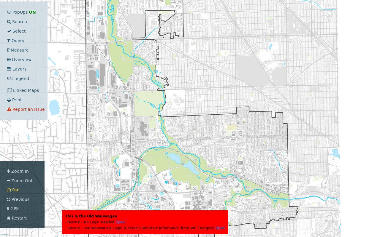
The viewer makes adjacent lots visible, but each popup remains a parcel record and not a complete list of people in the building.
Read Wauwatosa Parcel Fields
Street-directory work improves when four similar labels stay separate. The public GIS sample for 7725 Eagle St includes the owner, owner mailing city and ZIP, situs address, taxkey, parcel number, zoning, property class, tax year, land and improvement values, assessed and fair-market values, tax totals, legal description, acreage, and floodplain flag. The mailing and situs addresses match in that one sample, but that is evidence about one record only.
- Parcel
- A mapped unit of land with its own identifier and tax treatment.
- Situs address
- The physical address assigned to the parcel.
- Plat
- A recorded land-division map that identifies lots, blocks, and related boundaries.
- Criss-cross directory
- A printed directory arranged by address so a street number can lead to a listed person or business.
A different owner mailing address may reflect an office, another property, a prior address, or a tax-mailing choice. It is not proof of who occupies the situs. The legal description and taxkey are more reliable links when names or street labels change.
Wauwatosa Street Records Compared
Each address-keyed source contributes one layer to the Wauwatosa street directory. The strongest approach starts with a mapped parcel, carries its stable identifiers into the next source, and records the date and access limit of every result.
| Record Set | Keeper | What It Shows | Access |
|---|---|---|---|
| City tax roll | Wauwatosa Treasurer | Parcel, owner, address, assessment and tax | Free portal, data back to 2006 |
| WAGEO parcel map | Wauwatosa GIS | Boundaries, owner fields, zoning and legal context | Free map and REST service |
| Deeds and liens | Milwaukee County Register of Deeds | Recorded parties, instrument and legal description | Paid Tapestry, office, appointment, or mail |
| Voter information | Wisconsin Elections Commission | A person's own registration and districts | MyVote self-lookup; regulated file request |
| Permits and code cases | Wauwatosa Building Safety | Work, status, and released responsible-party details | EnerGov or records request |
| Historic reverse directories | Library and Historical Society | Dated address-to-name entries | Local shelf, GIS layer, and appointment |
The parcel number joins tax and GIS material. The legal description links a lot to recorded instruments. A street address connects a parcel to permits and printed directory entries, but the 1931 changes may require both old and new forms. Voter information needs separate care because MyVote is not a scrollable list by street.
Follow Wauwatosa Deeds Along Streets
Start the deed trail with the current parcel owner and legal description, then search Tapestry by the owner or business name. A deed result should be narrowed by recording date, instrument type, and legal description. Read the purchase deed for the seller, who is the grantor, then search that seller as an earlier buyer, or grantee, to move backward.
Tapestry costs $8.75 per search. Printed images cost $1.50 for the first page and $1 for each additional page, and certified copies are not available there. County deed images reach April 1, 1948. All-recording index and image coverage begins in 1962. Older books and non-imaged items require the Register of Deeds counter, mail request, or a historical search appointment made 24 hours ahead.
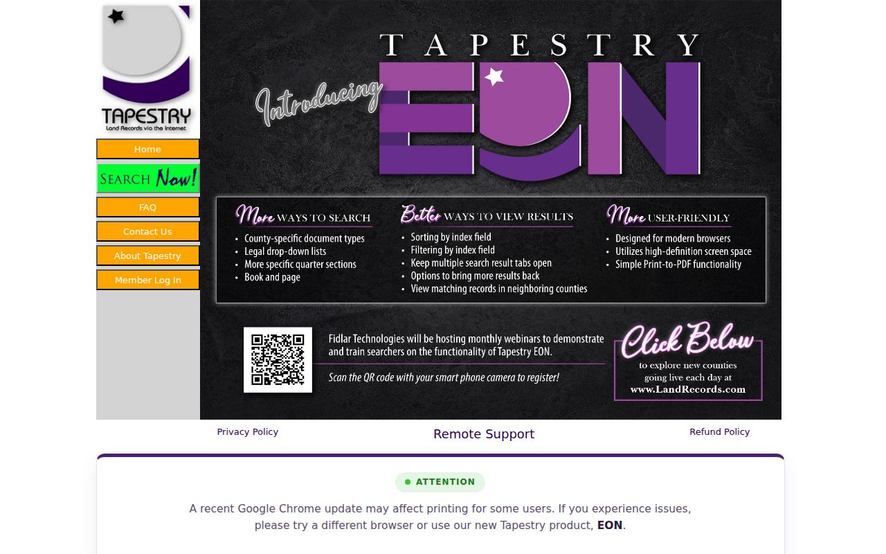
The paid index should follow a free parcel check, since an exact owner spelling and legal description reduce mistaken deed matches.
Bridge Wauwatosa Street Renumbering
The 1931 street-renaming and renumbering project is essential to any older Wauwatosa street directory. The 1932 directory records new names and number changes, while Milwaukee's 1930 conversion book includes Wauwatosa entries. Known examples include Albert Street to N 81st Street, Alexander Avenue to N 91st, Barnes Avenue to N 80th, and Berwyn Avenue to N 84th. Check the actual conversion entry and a map for each house.
Wauwatosa's 1952 annexation of 8.5 square miles adds another index shift. Earlier addresses may appear under Town of Wauwatosa, City of Wauwatosa, or Milwaukee. The current street name may fail even when the parcel survives. Use the taxkey, subdivision lot and block, or complete legal description as the stable bridge.
Match Old Wauwatosa Addresses
Historical reverse directories turn an address into a listed name for a specific edition. Wauwatosa Public Library and the Historical Society preserve overlapping Wright, Polk, and Bresser's runs with gaps. Consult the Wauwatosa city directory collections for the full year and publisher inventory rather than assuming that every year exists.
The Wauwatosa historical-directory GIS layer covers 42 directory categories from 1926 through 1992 and stores both an old full address and a current matched address. That is an unusual bridge between print and current map space. It remains a categorized subset, not every household entry, so open the original volume and verify the spelling, year, and address.
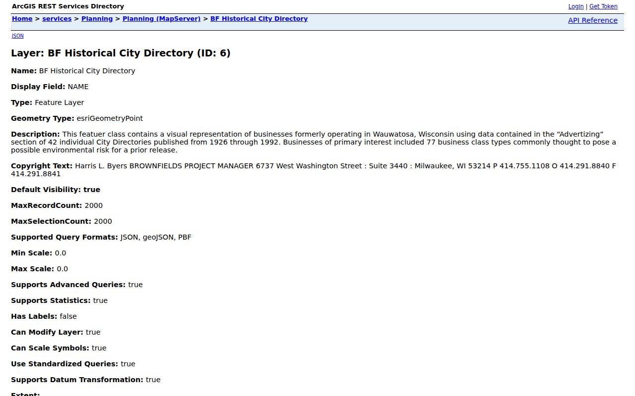
The layer metadata exposes the old-address and matched-current-address fields that support careful conversion work.
Check Wauwatosa Permits by Address
A permit or code record can date a structure change that explains a later parcel or address. Wauwatosa Building Safety oversees permit and inspection channels, and EnerGov supports self-service permit and status functions. The public guest field set was not confirmed in the research, so do not promise that every permit is searchable online.
When EnerGov does not expose an item, contact Building Safety or make a focused city open-records request. Supply the exact address, a date range, permit or case type, and parcel number if known. Property-maintenance complaints are not accepted anonymously. A permit may name an applicant, contractor, owner, project, inspection, or status when released, but it is building-history evidence rather than proof of everyone who lived there.
Separate Situs From Mailing Address
Wauwatosa GIS uses physical parcel fields such as ADDRESS, house number, street name, street type, and ZIP code. Separate owner fields carry the tax-mailing address, city/state, and ZIP. These two address families can match or differ. Neither result, by itself, gives a full household roster.
A different mailing address can indicate an absentee owner, an office, a former address, or a simple tax-mailing preference. A residential property class also does not prove that a named person occupies the building, and the inspected public GIS sample did not expose a verified homestead field. Keep the owner, mail recipient, listed directory occupant, and registered voter as distinct roles.
Understand Wauwatosa ZIP Labels
USPS answers a delivery question, while Wauwatosa GIS answers a parcel and city-boundary question. Some local addresses may display Milwaukee as the postal city even when the parcel lies in Wauwatosa. Census ZIP Code Tabulation Areas are statistical shapes and do not prove that every address inside a drawn area has the same postal service or municipality.
Use USPS ZIP Lookup to standardize the exact house number, street, city, and Wisconsin ZIP. Then use WAGEO to confirm the parcel and municipal boundary. The dominant local ZIPs are 53213 and 53226, followed by 53222 and 53225 in the city's 2018 resident survey, but edge addresses and small ZCTA intersections still require individual verification.
Handle Wauwatosa Voter Visibility
MyVote Wisconsin accepts first name, last name, and birth date in name mode, or street address, optional unit, city, and ZIP in address mode. It can show a voter their current registration, polling details, elections voted, elected officials, and absentee status. It does not show ballot choices or allow the public to browse everyone on a road.
A regulated voter-file request is a separate process under Wis. Stat. section 6.36. Full birth dates, operator-license data, Social Security data, identification serial numbers, accommodation indicators, and protected addresses remain withheld. Safe at Home participants and other protected voters should never be treated as targets for an address workaround.
Limits of Wauwatosa Street Directories
No Wauwatosa street directory provides a full, current roster for every address. A parcel roll lists an owner for tax purposes. A recorded instrument lists parties to a transaction. A historic directory may list one householder or business while omitting relatives and other occupants. MyVote is a self-lookup, and utility, delivery, and DMV address data are not ordinary public directory fields.
Privacy programs can also make an accurate record look incomplete. Wisconsin Safe at Home substitutes an assigned public address for an eligible participant's actual location. Protected-voter rules and residence suppression for qualifying judicial officers limit other displays. Missing information is sometimes a safeguard, not a search error.
Lawful use. Use Wauwatosa address records only for legitimate personal research. Never use them to stalk, harass, intimidate, or harm anyone.